


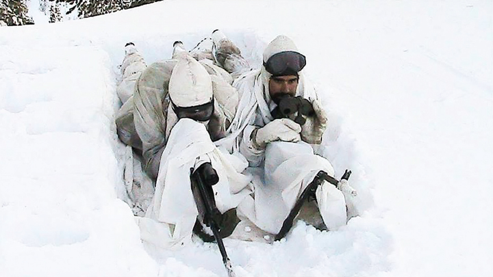
Siachen Glacier is the highest and the world's most inhospitable battleground where Pakistan and India, two nuclear-armed neighbours, have been eyeball to eyeball since 1984. Weather is the toughest challenge in Siachen as most casualties on both sides occur due to the severe climatic conditions and not on account of any military skirmishes or grey zone conflicts between the troops of the two sides. Though both Pakistan and India fancy retracting from the deployed positions, yet the hostile environment precludes them from exercising such an option.
Derived from the Balti language, the word ‘Siachen’ is a combination of words “Sia” meaning rose while “Chun” refers to any object found in abundance. Thus the name Siachen implies a land with an abundance of roses. The 76-kilometre long glacier lies at approximately 6000 metres above sea level and happens to be the longest glacier in Karakoram Range and the 2nd longest in the world’s non-polar regions. It extends from Saltoro Ridge in the west to Karakoram Range in the east. It acts as a wedge between Shaksgam Valley, ceded to China by Pakistan and Baltistan. The average winter snowfall is about 35ft while temperatures can dip as low as -50 Celsius. It is thus an unpopulated territory.
The conflict in Siachen stems from the incompletely demarcated territory on the map beyond the point NJ9842. The 1949 Karachi Agreement and 1972 Simla Agreement between Pakistan and India merely stated that the Cease Fire Line (CFL) terminated at NJ9842 but both pacts did not clearly mention who controlled the glacier. It was understood that the boundary further to this point would run in the general direction of north. Perhaps, it was also presumed that there would be no dispute between both the countries over such a cold and barren region. Both countries, however, lay territorial claims over the glacier. Pakistan claims that the boundary further to NJ9842 runs in north easterly direction, while India perceives it to be running in the northerly direction. Post border agreement with China in 1963, Pakistan started giving approval to the western expeditions to the east of mountain K2. In the 1970s and early 1980s, several mountaineering expeditions applied to Pakistan to climb high peaks in the Siachen area and were authorised by the Government of Pakistan. This reinforced the Pakistani claim on the area.

The writer is associated with the Institute of Regional Studies, Islamabad. She has interest in international politics and South Asian security dynamics and can be reached at reema.asim81@gmail.com
Leave a Reply