Pakistan Navy’s New Clout
When the Pakistan Navy inducted the Chinese-built survey vessel PNS Behr Masah into its fleet recently, it developed a new hydrographic, oceanographic and geographic survey capability.
The Pakistan Navy has recently inducted the survey vessel PNS Behr Masah into its fleet. This is an over 3000 ton survey ship which is equipped with state-of-the-art equipment and is fully capable of undertaking hydrographic, oceanographic and geophysical surveys as well as seafloor mapping in shallow and ocean depths.

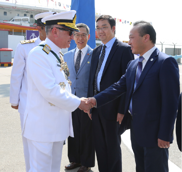
PNS Behr Masah was commissioned at the Pakistan Navy Dockyard in Karachi by Chief of the Naval Staff, Admiral Zafar Mahmood Abbasi.
The Naval Chief appreciated the efforts and commitment of Dajin Shipyard of China for its excellent workmanship and timely completion of PNS Behr Masah.
fter undergoing various stages of construction followed by rigorous sea trials, Behr Masah left China and voyaged through the Pacific and Indian Oceans to reach Karachi without being refueled at any point in the voyage.
With the induction of PNS Behr Masah, the hydrographic survey capabilities of the Pakistan Navy have been brought at par with many developed maritime nations. The PNS Behr Masah was envisioned as an all-weather ship that would enable Pakistan Navy to undertake effective hydrographic, geophysical and oceanographic surveys with modern equipment.
The ship has two state-of-the-art survey motor boats, which can undertake systematic and detailed mapping of shallow waters. PNS Behr Masah will effectively carry out hydrographic surveys of Pakistan’s Exclusive Economic Zone (EEZ) and the extended continental shelf. It will also map the ocean floor to produce nautical charts and Electronic Navigation Chart (ENCs).
PNS Behr Masah will also help support marine scientific research and geo-resource mapping surveys with oceanographic cruises, sea trips and deployments. It will also strengthen Pakistan’s marine scientific research capability and provide Pakistan Navy the flexibility to carry out underwater search and localization operations

Besides maintaining safety of navigation at sea, PNS Behr Masah will augment the promotion of Resource Exploitation in Pakistan’s EEZ and provide environmental protection and management through information about bathymetry and sea floor characteristics, Maritime Boundary Delimitation and enhancement of maritime defence and security.
The ship will reinforce the development of Pakistan’s maritime infrastructure through compilation of data regarding tides and waves besides providing Tsunami Flood and Inundation modelling. Hydrographic data is a critical asset for any activity at sea and in coastal areas and bathymetry is one of the most relevant contributions to the marine community. Hydrographic data feeds nautical charts and maritime projects.


Despite meagre resources and a difficult survey environment, the Pakistan Navy still has a strong tradition in hydrography. The Navy’s Hydrographic Department is already contributing efficiently to the nation’s economy, trade, marine research, maritime security and conflict resolution with neighbouring countries. It is also increasing the awareness of policy-makers and stakeholders about maritime issues.![]()
The writer is a seasoned Hydrographer and has served in the Pakistan Navy Hydrography Department. He was also involved in construction of the ship in China. |
|
Cover Story
|
|
Interview
|
|
Around Town
|
|
Tribute
|
Update
|


Leave a Reply